Sunday, March 12, 2017

Fort Santo Angel


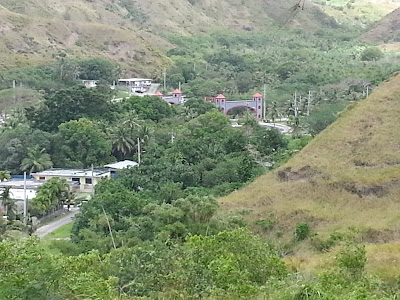
 This is where the fort was, you can see some of the remains, 

Fort Santo Angel was the second of four Spanish fortifications built in the southern village of Umatac in the midst of the galleon trade era. The fort was constructed on top of a large rock structure that is situated at the entrance to Umatac Bay. From this vantage the fort could defend the anchorage and the channel entrance to the bay from the increasing number of non-Spanish ships navigating through the Mariana Islands.

By the early eighteenth century, Great Britain, Holland, and France had increased their presence in the Pacific. To allay this threat, Spain launched a naval expedition in 1716 that captured six illegal French merchant vessels. With Great Britain and Holland still a threat in the Pacific, Spain initiated plans to improve Guam’s defenses. An earlier incident on Guam had also alarmed the island’s governor, Juan Antonio Pimentel (1709-1720). In March of 1710, four war ships, under the command of English privateer Captain Woodes Rogers, anchored off of Umatac Bay with 200 well-armed and battle-ready crew members.

This episode, however, encouraged Pimentel to write Spanish authorities regarding the importance of defending Guam as a last line of defense before the Philippines. With the increasing presence of foreign ships with well-trained crew members skirting the island, Pimentel recommended that a fort be built at Umatac in addition to the existing shoreline battery. The plan for Fort Santo Angel was realized sometime within the next three decades. The earliest historical record of the fort was made by British Commodore George Anson in 1742 through information he received while anchored at Tinian.

In 1756 Governor Enrique de Olavide y Michelena (1749-1756 and 1768-1771) rebuilt Santo Angel after he observed that the artillery emplacement there was merely protected by ditches in the rock. The new fort was also built atop the fifty-foot high rock-like promontory and was accessed by steps cut into the rock. On the top of the promontory was a flagstone esplanade that measured forty by twenty-four feet. Surrounding the esplanade was a one-foot-high and eighteen-inch-thick mampostería, stone and mortar, wall.

Separating the esplanade and the stone steps was a thirty-foot-long entranceway. A mampostería guard room measuring ten feet by fifteen feet was also erected on the bay side of the entranceway. Santo Angel was built to house three cannons that could effectively damage ships, but its wall was low which left soldiers and gun-carriages exposed to enemy fire.

Over time the fort suffered damage to its foundation from years of pounding waves. Governor Alexandro Parreño (1806-1812) determined the fort to be unsafe and had it dismantled. The existing structure, without its guns, was used to hold piles of wood which, when lit, provided safety for ships at night. Today, ruins of the fort can still be seen along Umatac Bay’s north entrance. However thick vegetation covers much of the site. Then we went up the hill to another fort that was used at this time also.


We learned that Monday they would reenact Magellan when he came to the island and took over the village. We decided that we would come for FHE to see this.

 forces could be overwhelmed, struck a deal that allowed the privateers to re
This episode, however, encouraged Pimentel to write Spanish authorities regarding the importance of defending Guam as a last line of defense before the Philippines. With the increasing presence of foreign ships with well-trained crew members skirting the island, Pimentel recommended that a fort be built at Umatac in addition to the existing shoreline battery. The plan for Fort Santo Angel was realized sometime within the next three decades. The earliest historical record of the fort was made by British Commodore George Anson in 1742 through information he received while anchored at Tinian.
In 1756 Governor Enrique de Olavide y Michelena (1749-1756 and 1768-1771) rebuilt Santo Angel after he observed that the artillery emplacement there was merely protected by ditches in the rock. The new fort was also built atop the fifty-foot high rock-like promontory and was accessed by steps cut into the rock. On the top of the promontory was a flagstone esplanade that measured forty by twenty-four feet. Surrounding the esplanade was a one-foot-high and eighteen-inch-thick mampostería, stone and mortar, wall.
Separating the esplanade and the stone steps was a thirty-foot-long entranceway. A mampostería guard room measuring ten feet by fifteen feet was also erected on the bay side of the entranceway. Santo Angel was built to house three cannons that could effectively damage ships, but its wall was low which left soldiers and gun-carriages exposed to enemy fire.
Over time the fort suffered damage to its foundation from years of pounding waves. Governor Alexandro Parreño (1806-1812) determined the fort to be unsafe and had it dismantled. The existing structure, without its guns, was used to hold piles of wood which, when lit, provided safety for ships at night. Today, ruins of the fort can still be seen along Umatac Bay’s north entrance. However thick vegetation covers much of the site.

Outdoor library


This library is not a building where you may expect to enter through a door, see windows, nor be covered by roof. This library is best described as a large, highly decorative, cement bookshelf.
This small monument-like structure, built in October 1933, served as a place where villagers could exchange books. It was built under the direction of early twentieth-century education pioneer and politician Francisco Quinta Sanchez, a resident of the southern village.

Located near the modern-day San Dionisio Catholic Church, the structure sits right next to the village’s main road, and visitors can see it as they drive slowly through the narrow Umatac road. With its walls partially crumbled, it now serves as another proud reminder of Umatac’s historic past.

San Dionisio Catholic Church


The church of San Dionisio was constructed of wood with a palm thatched roof and dedicated in 1681. It was later burned in 1684 by those Chamorros who opposed the Spanish, rebuilt again of wood, and destroyed again by a typhoon in 1693. It was rebuilt in 1694 of coral masonry.

By 1690, after two European disease epidemics killed a large number of Chamorros, Umatac was the largest of five parishes on Guam, with 700 people. In the early 1700s, Rota, Guam’s neighbor island to the north, was at times administered together with Umatac by the church, resulting in close ties between Chamorros in those two parishes.

In 1849 a massive earthquake on Guam demolished many buildings including the governor’s palacio, the San Dionisio Church and the convento (the priests’ residence). Only the church was rebuilt, of wood and that structure was destroyed in the severe earthquake of 1902 that also crumbled part of the Dulce Nombre de Maria church in Hagåtña. The San Dionisio church would not be completely rebuilt until 1939 at a new location, where it still stands.

The Spanish masonry ruins of the old San Dionisio Church, which are located within fifty yards of the current church, are marked by a plaque, and are on the National Register of Historic Places.


This is the church today it sets to the side of the ruins of the old church.


Francisco Q Sanchez School

We took a tour of the village, the youth wrote a script and memorized it, the tour was with the youth (some could have still been children). At each stop they explained the history of the place. We started at the elementary school. They are hoping to restore it, it is place on historical places on the island.
Francisco Quinata Sanchez Elementary School, more commonly referred to as F.Q. Sanchez Elementary, is one of twenty-five public elementary schools on Guam. It was named in honor of Sanchez who was an twentieth century pioneering educator and politician of Guam.

Because of its small student population, lawmakers proposed closing the school and sending its students to Merizo Martyrs Elementary School in the neighboring southern village. Umatac residents, however, strongly opposed this move.

In 1998, the school was listed in both the Guam and the National registers of historic places. It was constructed in 1953 by world-renown architect Richard Nuetra who also designed the Guam Government House.


Saturday Adventures with all the senior missionaries....

We started our day getting into the service center minivan, we headed south to the village of Umatac (Humatac). There was a celebration commorating Heritage Days for this island.

The history of Umatac is among the most rich of all the villages of Guam, especially during the Spanish era. Among other distinctions, Umatac is the home to Fouha Bay in which a rock called “Fouha” Rock sits. The ancient Chamorros believed this rock to be the resting place of a goddess called Fu’una who, with her brother Puntan, is credited with creating the world and people. The rock is also called Creation Point.

The pre-contact Chamorros made a pilgrimage to the rock every year to pay homage to Fu’una and to have their rice blessed to be used to cure people according to Spanish accounts. Umatac is perhaps most famous for being the site, by long oral tradition among the Chamorros, Ferdinand Magellan first landed on Guam. Although other theories about Magellan’s landing site have arisen, the residents of Umatac still proudly celebrate Discovery Day every March 21st with a re-enactment of the 1521 landing.

The next landing by Europeans on Guam, that of Miguel Lopez de Legazpi, forty-four years later in 1565, was indisputably at Umatac. Legazpi anchored at Umatac Bay for thirteen days and formally claimed Guam for Spain, and during his stay, a Catholic mass was celebrated in a large cruciform canoe house by the bay.

By the time of Legazpi’s visit, Umatac was already a Chamorro coastal settlement that included a large communal house raised on latte stones, so spacious it could accommodate 200 people along with large canoes, as described by the Europeans. There were also other low houses in which the Chamorros cooked and roasted food.

Umatac was the chief port for the Spanish during the early galleon days, when it was visited annually by a galleon from Aculpulco, usually in May or June. In late 1680, a Spanish settlement was established at Umatac for the first time to serve the galleons, along with a supply ship that stopped on Guam from Cavite in the Philippines, usually in August or September. The supply ship brought necessities such as soap, flour, tools, metal, animals and seeds. The galleon also brought supplies, but mainly Spanish money of Mexican silver to pay soldiers and mission personnel.

These visits were so important that the Spanish governor transferred his residence from Hagåtña to Umatac when the ships were expected. Governor Damian de Esplana built the governor’s palacio, or palace, surrounded by a presidio compound in Umatac in 1690. After the supplies were unloaded from the ships, they were transported by boat from Umatac around Orote Point to Hagåtña since no road existed between the two towns.

Between 1680 and 1810 the first fortification built in the presidio was the Bateria de Nuestra Senora Del Carmen located in the bay. Followed by Fort Santo Angel (1756) built at the entrance of the bay on top a large rock. The third structure, Fort San Jose was built around 1805 on a hill located north of the village. Lastly, one of the most popular tourist’s sites on island, is Fort Nuestra Senora de la Soledad or Fort Soledad. It was built around 1810 above the southern part of the bay.


Sunday, February 26, 2017

Fort

We drive by the sign for this fort every time we go to the VA doctor to take Art. So we decide to drive down the road to see what it was here are some pictures. There is not much of the fort but the view is amazing!


Old Fashion Bakery....


Inarajan Cultural Village

We have been to this village before but we always enjoy our visits. It shows what life was like in Guam in the early years. The host tells us how things were done when he was a child.