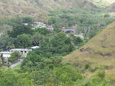
This is where the fort was, you can see some of the remains,
Fort Santo
Angel was the second of four Spanish fortifications built in the southern
village of Umatac in the midst of the galleon trade era. The fort was constructed
on top of a large rock structure that is situated at the entrance to Umatac
Bay. From this vantage the fort could defend the anchorage and the channel
entrance to the bay from the increasing number of non-Spanish ships navigating
through the Mariana Islands.
By the early eighteenth century, Great Britain, Holland, and
France had increased their presence in the Pacific. To allay this threat, Spain
launched a naval expedition in 1716 that captured six illegal French merchant
vessels. With Great Britain and Holland still a threat in the Pacific, Spain
initiated plans to improve Guam’s defenses. An earlier incident on Guam had
also alarmed the island’s governor, Juan Antonio Pimentel (1709-1720). In March
of 1710, four war ships, under the command of English privateer Captain Woodes
Rogers, anchored off of Umatac Bay with 200 well-armed and battle-ready crew
members.
This episode, however, encouraged Pimentel to write Spanish
authorities regarding the importance of defending Guam as a last line of
defense before the Philippines. With the increasing presence of foreign ships
with well-trained crew members skirting the island, Pimentel recommended that a
fort be built at Umatac in addition to the existing shoreline battery. The plan
for Fort Santo Angel was realized sometime within the next three decades. The
earliest historical record of the fort was made by British Commodore George
Anson in 1742 through information he received while anchored at Tinian.
In 1756 Governor Enrique de Olavide y Michelena (1749-1756 and
1768-1771) rebuilt Santo Angel after he observed that the artillery emplacement
there was merely protected by ditches in the rock. The new fort was also built
atop the fifty-foot high rock-like promontory and was accessed by steps cut
into the rock. On the top of the promontory was a flagstone esplanade that
measured forty by twenty-four feet. Surrounding the esplanade was
a one-foot-high and eighteen-inch-thick mampostería, stone and
mortar, wall.
Separating the esplanade and the stone steps
was a thirty-foot-long entranceway. A mampostería guard room
measuring ten feet by fifteen feet was also erected on the bay side of the
entranceway. Santo Angel was built to house three cannons that could
effectively damage ships, but its wall was low which left soldiers and
gun-carriages exposed to enemy fire.
Over time the fort suffered damage to its foundation from years
of pounding waves. Governor Alexandro Parreño (1806-1812) determined the fort
to be unsafe and had it dismantled. The existing structure, without its guns,
was used to hold piles of wood which, when lit, provided safety for ships at
night. Today, ruins of the fort can still be seen along Umatac Bay’s north
entrance. However thick vegetation covers much of the site. Then we went up the hill to another fort that was used at this time also.
forces could be overwhelmed, struck a deal that allowed the privateers to re
We learned that Monday they would reenact Magellan when he came to the island and took over the village. We decided that we would come for FHE to see this.
forces could be overwhelmed, struck a deal that allowed the privateers to re
This episode, however, encouraged Pimentel to write Spanish
authorities regarding the importance of defending Guam as a last line of
defense before the Philippines. With the increasing presence of foreign ships
with well-trained crew members skirting the island, Pimentel recommended that a
fort be built at Umatac in addition to the existing shoreline battery. The plan
for Fort Santo Angel was realized sometime within the next three decades. The
earliest historical record of the fort was made by British Commodore George
Anson in 1742 through information he received while anchored at Tinian.
In 1756 Governor Enrique de Olavide y Michelena (1749-1756 and
1768-1771) rebuilt Santo Angel after he observed that the artillery emplacement
there was merely protected by ditches in the rock. The new fort was also built
atop the fifty-foot high rock-like promontory and was accessed by steps cut
into the rock. On the top of the promontory was a flagstone esplanade that
measured forty by twenty-four feet. Surrounding the esplanade was
a one-foot-high and eighteen-inch-thick mampostería, stone and
mortar, wall.
Separating the esplanade and the stone steps
was a thirty-foot-long entranceway. A mampostería guard room
measuring ten feet by fifteen feet was also erected on the bay side of the
entranceway. Santo Angel was built to house three cannons that could
effectively damage ships, but its wall was low which left soldiers and
gun-carriages exposed to enemy fire.
Over time the fort suffered damage to its foundation from years
of pounding waves. Governor Alexandro Parreño (1806-1812) determined the fort
to be unsafe and had it dismantled. The existing structure, without its guns,
was used to hold piles of wood which, when lit, provided safety for ships at
night. Today, ruins of the fort can still be seen along Umatac Bay’s north
entrance. However thick vegetation covers much of the site.


No comments:
Post a Comment